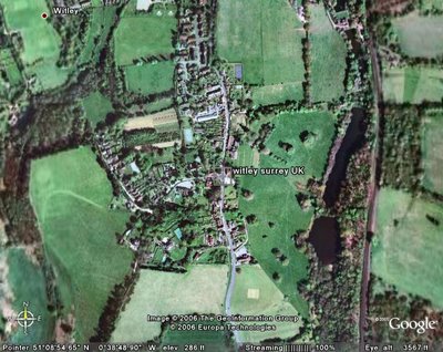
 Witley seen by Satellite
Acknowledgement
Google earth
About Witley
Grid reference SU9464939650
Geographical co-ordinates: 51° 8.8651′ N 0° 38.8′ W
Witley village is located around the A283 south of Milford, in Surrey. Witley Parish Council administers a population of 7,300 in an area of 11 sq miles in the Surrey Hills area of Outstanding Natural Beauty. It incorporates the hamlets of Brook, Sandhills, Enton and Wormley.
The last census revealed that Witley had a population of 7,703, with 6,001 aged over 16.
Witley is part of Waverley Borough, which is an administrative area covering 133 square miles, located in the south-west corner of the County of Surrey. It borders West Sussex to the south, Hampshire to the west, with the Surrey councils of Guildford and Mole Valley to the north and east. The borough has a population of 115,400 living in 48,500 households. Ethnic minority communities make up 1.4 per cent of the population compared with the national average of 5.
Over 80 per cent of the countryside in the Waverley Borough is designated as part of the Surrey Hills Area of Outstanding Natural Beauty or Area of Great Landscape Value.
 Acknowledgement
 Image produced from the Ordnance Survey Get-a-map service. Image reproduced with kind permission of Ordnance Survey and Ordnance Survey of Northern Ireland.
A list of other maps covering the Witley area can be found at the Wiki:Map sources/GB.

No comments:
Post a Comment